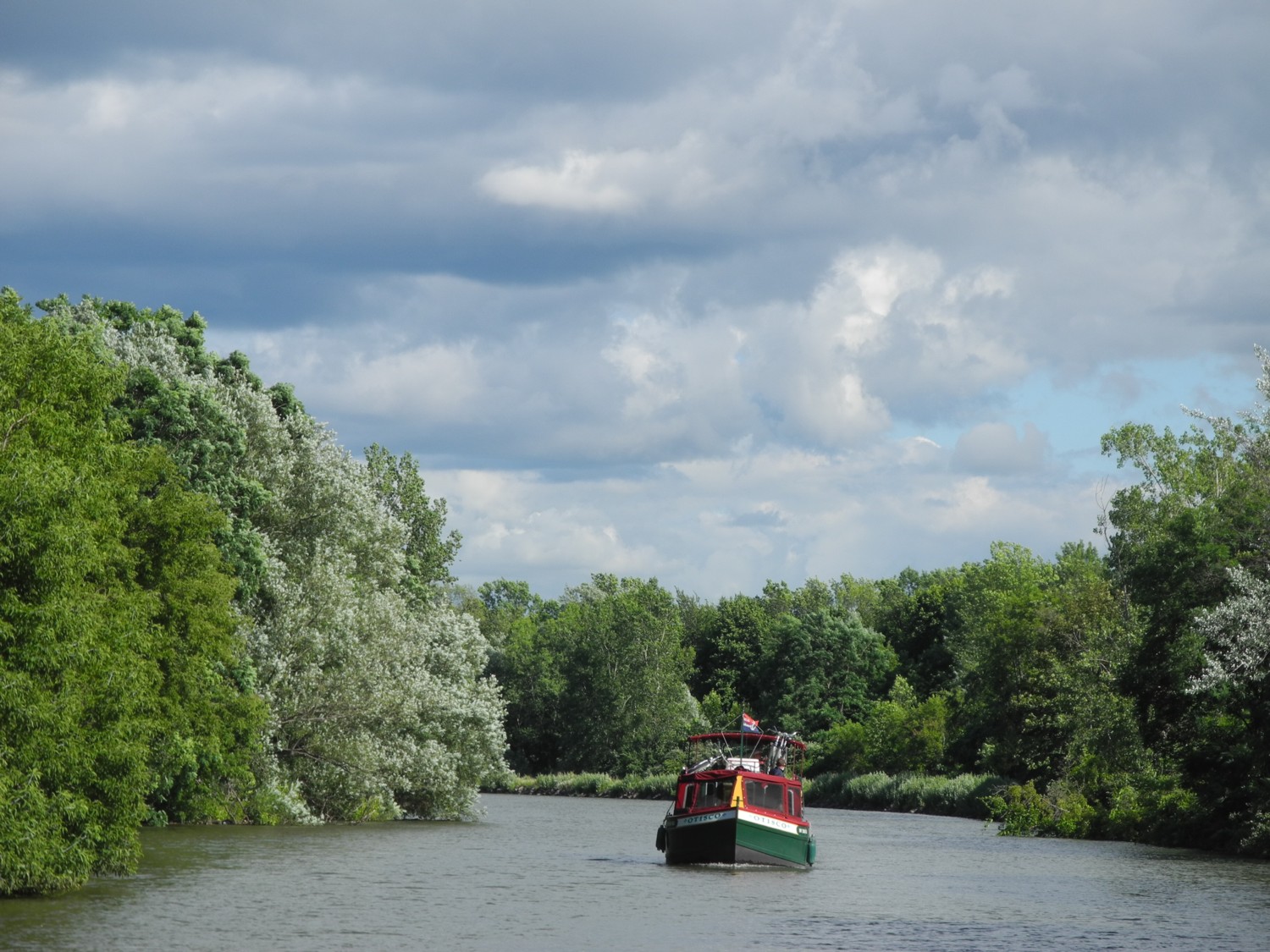
The Otisco, one of Mid-Lakes Navigation’s specially designed Lockmasters, cruising on New York’s historic Erie Canal © 2013 Karen Rubin/news-photos-features.com
Rochester, Spencerport, Brockport, Holley, Albion
by Karen Rubin
We awake on our second morning on the canal in Pittsford to beaming sunlight. I walk the couple of blocks from the canal park where we are docked to Starbucks where I can check my email.
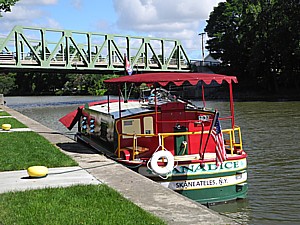
Awakening in Pittsford on our Lockmaster canalboat, the Canadice © 2013 Karen Rubin/news-photos-features.com
After breakfast, we set out on our voyage – our first real challenge ahead: Lock 32, followed a mile further on by Lock 33.
Piloting our Lockmaster, a houseboat specially designed for the Erie Canal by Mid-Lakes Navigation, has been surprisingly easy, though docking requires some skill and practice, and agility. But the locks have us most anxious.
Both these locks are distinguished because the lines we need to catch – so that our boat doesn’t float around the lock when it fills with water – are embedded in the concrete wall.
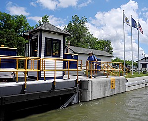
The Erie Canal lift operators like Paul, patiently guide us in how to dock the canal boat and catch the wire embedded in the wall © 2013 Karen Rubin/news-photos-features.com
The lift operators are particularly helpful – they are very sympathetic to the fact that we are not experienced boaters (in fact, Matt, who has given us our two-hour orientation on the Canadice, says the operators nickname the Lockmasters “bumper boats”). Paul, the operator here, patiently shows us how to put our line behind the wire. It is very windy today, and he actually makes the water flow so that the boat pushes back to the wall.
The lock operators also ask where you are headed, so that they alert the operators along the way – at the lift bridges and locks – that you might be coming. Often, the operators are responsible for more than one bridge or lock, and have to travel between the them . (A site provides locations and information about the Erie Canal’s locks and lift bridges, www.100megsfree3.com/wordsmith/statistics.html).
After we make it through the locks, we are bound for our next thrill: just south of Rochester, the Erie Canal crosses the Genessee River which is one of the rare rivers that flows to the north, emptying into Lake Ontario. This is another remarkable example of engineering that involved a dozen bridges, east and west of the river.
There are literally four-corners. We make a right turn from the canal onto the Genessee River to travel into Rochester’s downtown, 4 miles further.
We are headed to Cornhill Landing, the dock in downtown Rochester, beyond which you cannot go any further because there are rushing falls right in the city. But along the way, we see a dock and assume that is Cornhill Landing. It is directly across the river from the University of Rochester campus on the eastern shore, and is not on the chart. This turns out to be Brooks Landing, attached to a relatively new hotel, the Springbridge Suites, that serves the University of Rochester.
It proves a better place to tie up anyway. We take our bikes and ride along a bike trail alongside the Genessee River (best to ride the eastern shore), up to the falls and then return to the boat.
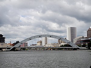
Rochester, New York, a city that developed largely because of the Erie Canal © 2013 Karen Rubin/news-photos-features.com
The Erie Canal turned Rochesterville into an American “boom town” and today, it is the third largest city in New York State, my brochure says. The canal first went through the center of the city, across an 800-foot aqueduct over the Genessee River – a major achievement at the time. A second, sturdier version, built in 1842 to replace the original aqueduct, can be seen at the base of the Broad Street ridge.
Eventually, as Rochester was built up and the canal interfered with traffic, the canal was rerouted to bypass the city. You can see old Lock #65 along the 490 Expressway. The High Falls Historic District has an interpretive center, archeological site, pedestrian bridge across the gorge, and the 96-foot waterfall. There are also nightclubs, restaurants, shops that fill former factory and warehouse spaces, and Rochester is renowned for its museums. During our visit, a popular Jazz Festival is underway.
I am not really in a Big City mood, though. I’ve been enjoying our sojourn into small-town America too much, and after our brief visit to Rochester, we set out again on the canal, continuing our west-bound journey.
Before long, once we get passed Greece (there are several towns here named for countries – Sweden, Egypt) and we are back into a rural looking setting which makes you forget entirely that you are in New York State or even in the 21st century.
As we sail along on our way to our next port, I reflect how they built the canal three or four times: in 1822-3, during the Civil War (mind-boggling), in the late 1800s, and again, 1917-1918 (during another war); the west is all man-made, but the east used existing lakes and rivers.
Beginning in the 1980s, the canal was transformed from commercial use and now is almost entirely for recreational use – boating, kayaking, canoeing, crew, fishing, though not long ago, it was used to transport two fighter jets from the Intrepid in New York City to another museum, and blades for wind turbines (a harbinger of the future, perhaps?).
In the 1980s, the control of the Erie Canal was shifted from New York State’s Department of Transportation to the quasi public-private New York Thruway Authority, which established the New York State Canal Corporation, funded by the fees charged the boat operators (like Mid-Lakes), which pays for the operators and the maintenance.
I think how glorious the Canal must be in fall – lined with maples, oaks (Mid-Lakes Navigation operates until mid-October; the Canal is actually closed on Nov. 1, when they pull the plug; the canal is refilled around May 1).
The canal is absolutely beautiful between Greece and Spencerport – the landscape and the bike trail as well.
We arrive at Spencerport, where we dock for the night (no charge here; the south side has access to water as well as electrical plug ins, and the Spencerport Canal Museum serves as a welcome center with computer and WiFi, showers; the north side only has electrical plug in, and a delightful picnic pavilion).
We still have an hour or so of daylight (we are here during the longest days of the year), so we take our bikes westward on the bikeway towards Adams’ Basin, where we find the charming Adams Basin Inn (315-352-3999), beside the lift bridge. Historical photos at the marker show that the inn has been in the same place to serve the canal as long as the canal has existed.
It’s about 8:30 pm by the time we get back to Spencerport. Someone tells us about a charming bistro, Bad Apples, at Brockport & Spencerport Road. But it is a pretty long walk to get there and we don’t think we can make it before 9 pm when it closes, so we find Tops grocery store (open 24/7) and a Chinese Take Out (Chef King) that proves absolutely fabulous, and have another picnic dinner under a pavilion on the canal beside the boat.

Sunset in Spencerport, where we tie up on the Erie Canal for the night © 2013 Karen Rubin/news-photos-features.com
Spencerport’s slogan is “Someplace Special.” The village began as Ogden Center in 1802 and became Spencerport in 1825 after the Erie Canal was cut through Daniel Spencer’s land. Shops developed along Main Street to serve the boats and passengers brought by the canal. We find few shops on Main Street today.
Our houseboat is very much like a floating RV, but one of the big differences is that our “house” goes right to the downtowns, rather than an RV which goes to camp grounds.
Tuesday: Spencerport-Brockport-Holley-Albion
We wake in Spencerport to brilliant sun, blue sky, a bit of a wind and a chill in air, but the sun is hot.
I have been enjoying the idea of traveling without any schedule or itinerary, but reality sets in as I realize we will have to make it back by 9 am on Saturday. I have to abandon my hope of getting to North Tonawanda, the farthest point you can go on the canal in order to see Niagara Falls.
We will not even make it as far as Lockport, where I was so anxious to see the last remaining “original” section of the Erie Canal and the historic 1842 “Old Flight of Five” staircase locks (replaced by Locks 334 and 35) (it takes about 25 minutes to go through each of the locks, so you have to tack that onto your travel time).
I make a plan of action: to stop and stay tonight at Albion and bike along the bikeway 12 miles to Medina (since we bike twice as fast as we boat). At least, then, we will have traveled most of the route of the “100 Must See Miles of the Erie Canal.”
As we chug along on our travels today, the wind against my face and this openness to the surroundings, there is something very special about the experience of piloting the canal boat, seeing the canal from the water.
From this perspective, you can best appreciate what a marvel of construction, capitalism and can-do spirit the Erie Canal was.
You have an enormously satisfying feeling of acquiring skills, knowledge of handling the boat, doing it yourself, being on your own.
As we near Brockport, I finally see a farm, as we enter an agricultural region.
Brockport has lift bridges at its east and west entries. We arrive at Brockport 12:35 pm. There is a very welcoming visitor center here, and the most well-equipped port for boaters we have found (it is also the only one we encounter on our trip that charges; up to $15 for a boat 40 feet or more).
Here, you can borrow a bike for an entire day (return by 7 pm; don’t expect great bike); use Wifi and a computer, see TV, DVD, use the restroom and shower, washer and drier, telephone (local calls), copier and fax machine, grab a cup of coffee pot, brochures and maps. The visitors center is staffed by 100 volunteers.
Brockport has a pleasant, revitalized Main Street – but not much in the way of interesting shops, except for what is claimed to be the biggest bookstore in the region (this is a college town, SUNY Brockport is walking distance).
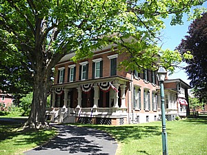
I come upon the Morgan Manning House, on Main Street. I learn that a pioneer reaper industry was developed on Erie Canal banks by William H. Seymour and Dayton S. Morgan. This 1854 dwelling became the Morgan family home in 1867. The eldest daughter, Sara, wife of Frederick A. Manning MD, lived here until died, 1964. The building was deeded by the Landmark Society of Western NY and Western Monroe Historic Society (637-3645).
Brockport, it turns out, was where Cyrus McCormick found a factory to manufacture his reapers, to meet the growing demand of orders from farther west (there is a marker near the dock).
Another marker describes Luther Gordon who “epitomized Brockport involvement in canal commerce during its heyday.” Gordon owned the sawmill and 7000 acres of timberland; he shipped 2-4 million board feet of lumber, 400,000 pounds of buildingstone on the canal throughout NYS. Gordon also was founder and president of the First National Bank of Brockport which served as the repository of canal tolls collected here.
We walk passed the First National Bank Building, with the dates 1864-1927, on Main Street.
This was the Industrial heartland – as we travel, I am struck by how many innovations came from this area. The towns today show skeletal remains of those glory days, when these towns were important, and had a place in global commerce.
At about 3 pm, we bike from Brockport west, to Holley, just about 5 miles away, and arrive by 3:40. Here there is a pleasant parkline port and a bikepath named the Andrew Cuomo Canalway. opened in 2000 (It was built with a $1 million grant from HUD, when Andrew Cuomo was Secretary, under the Canal Corridor Initiative. The trail is only 100 yards long; two 5-foot-tall Medina sandstone monuments inscribed with his name mark the entrance).
Holley was settled in 1812 and established on the original Erie Canal. This was an enormous and complicated loop that was changed, putting the town a few blocks from the canal. The restored railroad depot (circa 1907) s now a museum.
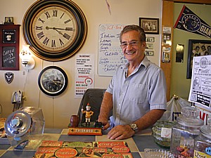
We bike the short distance into the center of the village – literally a public square, bordered on all sides by lovely buildings, including the Odd Fellows Hall (1890), and several charming shops, like Jonathan’s Pastry and the Goodie Shop, where proprietor Bill Billotti offers ice cream and collectibles, and on Thursday nights, presents the Goodie Shop Singers (7-9 pm). I note the “Save the Old Stone Store” signs.
Billotti tells us about the village’s unique attraction, the Holley Falls, and we follow the signs to see the falls.
Holley was the center of an Italian immigrant community who were brought over to work the sandstone quarry at Medina (the sign says, “affectionately called, Podunk”). Billotti’s own father came as a shoemaker, and he was a mason before he retired and took over the shop.
We leave Holley by 4:45 pm for the six mile bike ride and are back at the boat in Brockport a half hour later – not bad for the six miles.
We have been leapfrogging ports so that on our return, we can stay in different wants. So we depart Brockport for Albion, which I calculate will take 2 ½ hours. I use the chart book to estimate the distances and see that we will have to cross 3 lift bridges.
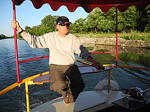
Piloting the Canadice on the Erie Canal in the quiet of the summer evening, on our way to Albion © 2013 Karen Rubin/news-photos-features.com
There are hardly any other boats on the canal now. It’s like having the canal to ourselves.
What a feeling: the bridges lift for you; the locks load for you. You get the hang of reading charts (I ask operator approximate time will take from Albion to Holley, 1 ½ hours, as I calculated)
He tells me “see you at the next lift” – in a half hour, since he covers both.
The long days of summer make a difference to what you can do: we want to do about 2-4 hours of biking and 2-4 hours of boating and 2-4 hours of visiting/touring a day.
Albion is an agricultural area with orchards, fields and farms which come into view after the Keitel Bridge.
We dock at Albion at 8:20 pm just as the sun is going down.
There are several fast food places here, but the only restaurant we can find that is open late is the Village House diner, a few blocks walk up Main Street. Main Street is dead at 8:45 pm.
Helpful contacts:
Mid-Lakes Navigation, 11 Jordan St, PO Box 61, skaneateles, NY 13152, 315-685-8500, 800-545-4318, www.midlakesnav.com.
Erie Canalway National Heritage Corridor, PO Box 219, Waterford, NY 12188, 518-237-8643, ext 3110, www.eriecanalway.org.
See also:
Journey by boat and bike along the Erie Canal: Macedon-Fairport-Pittsford and slideshow
Erie Canal journey by boat, bike: Exploring canaltowns from Pittsford to Albion and slideshow
Erie Canal journey: Albion-Medina bikeride is most scenic, illuminating and slideshow
Erie Canal journey by boat and bike: Palmyra, ‘Queen of Canal Towns’ and slideshow
New season of self-skippered canalboat cruises on New York’s historic Erie Canal (Photos)
______________________
© 2013 Travel Features Syndicate, a division of Workstyles, Inc. All rights reserved. Visit www.examiner.com/eclectic-travel-in-national/karen-rubin, www.examiner.com/eclectic-traveler-in-long-island/karen-rubin, www.examiner.com/international-travel-in-national/karen-rubin and travelwritersmagazine.com/TravelFeaturesSyndicate. Blogging at goingplacesnearandfar.wordpress.com. Send comments or questions to FamTravLtr@aol.com. Tweet @TravelFeatures. ‘Like’ us at facebook.com/NewsPhotoFeatures.

